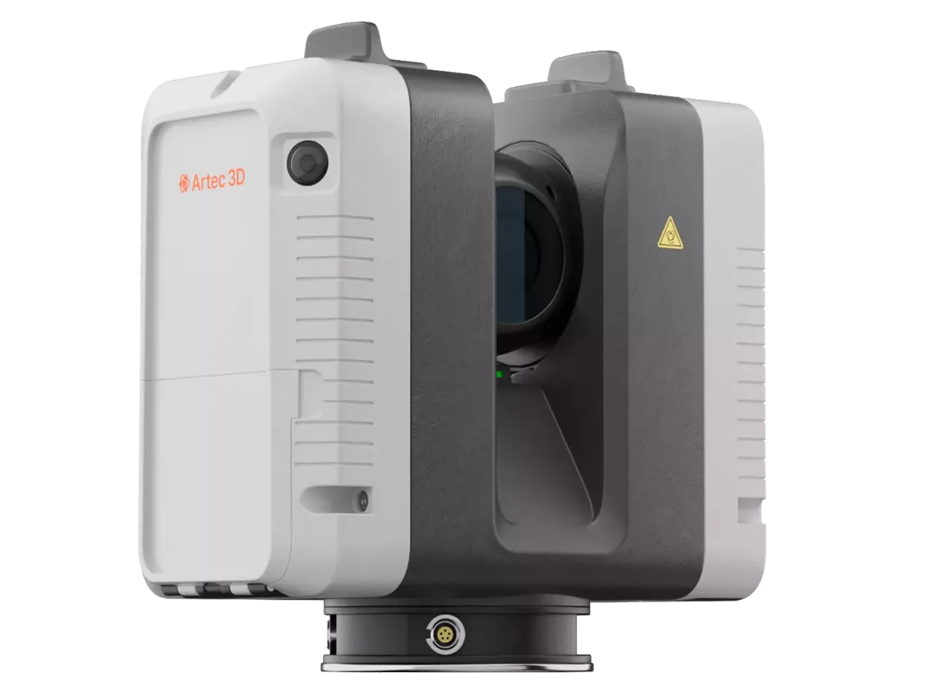
Artec Ray II
Lighting-Fast, Long-Range LiDAR Scanning
Metrology-Grade Reality Capture From Up to 130 Meters Away
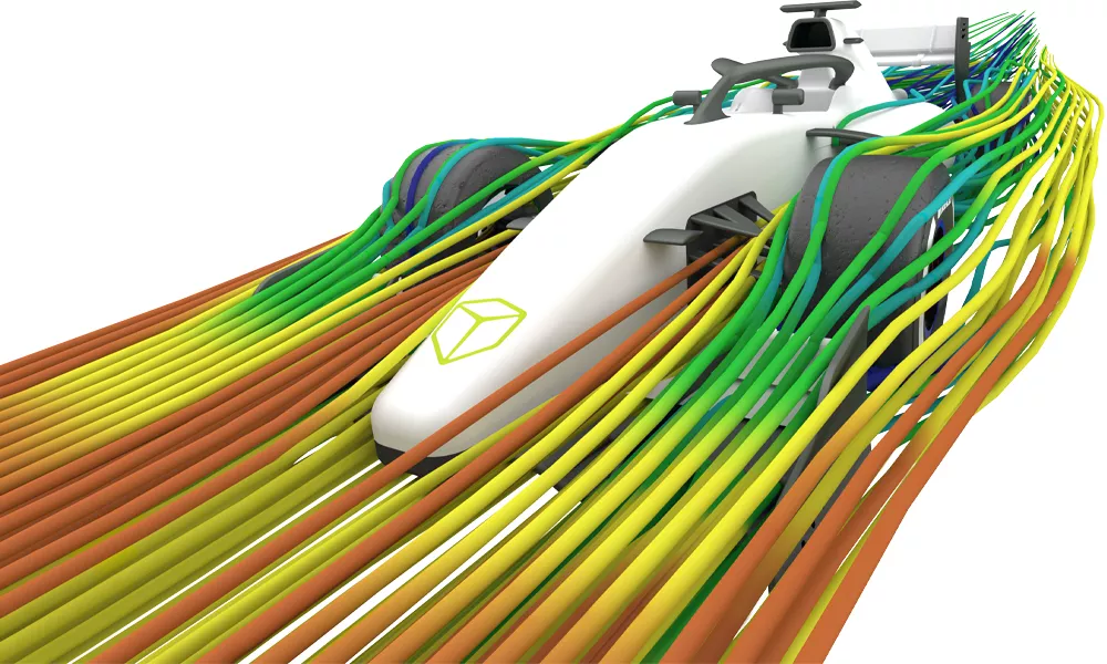
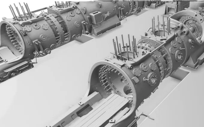
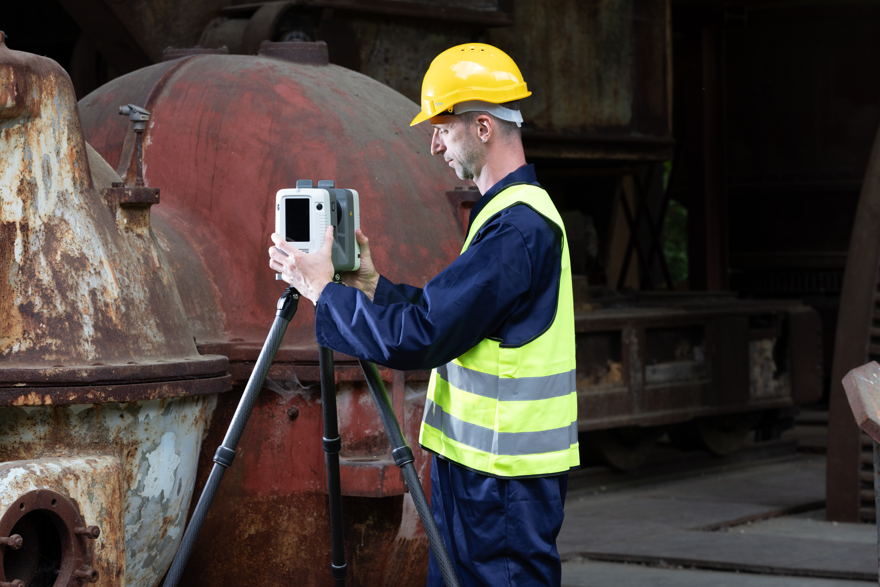
The Artec Ray II completely redefines large-scale 3D data acquisition by bringing metrology-grade accuracy to massive objects, civil infrastructure, and entire factory environments. Built to minimize downtime, this high-speed terrestrial LiDAR system scans from up to 130 meters away, capturing a full 360-degree dome at maximum resolution in just 1.7 minutes.
Unlike traditional long-range scanners that necessitate rigorous manual data cleanup, the Ray II features targetless on-board registration powered by an advanced Visual Inertial System (VIS). It tracks its own spatial position from one setup to the next in real time, automatically pre-aligning your point clouds before you ever import them.
Features
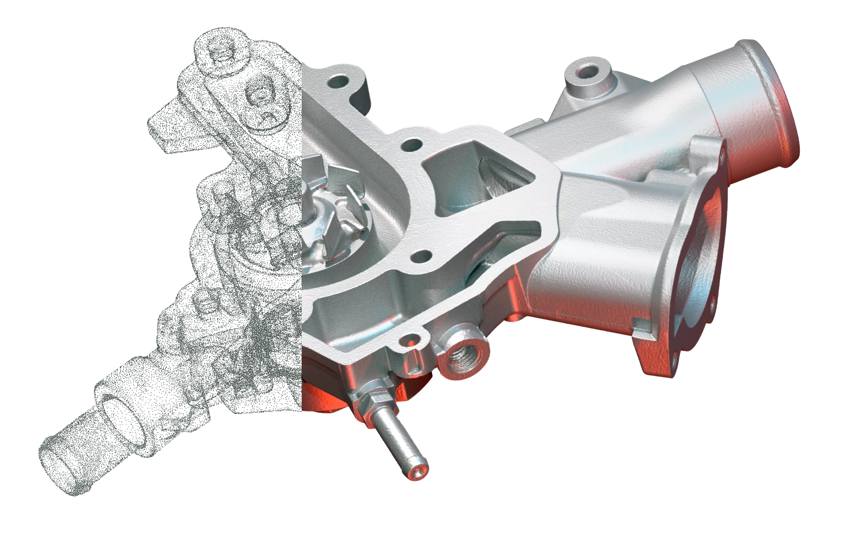
Blistering 2 Million Points/Second Capture
Reconstructs entire aircrafts, wind turbines, or facilities at breakneck speeds, generating clean raw data with an uncompromised 3D point accuracy of 1.9 mm at 10 meters.
Automated Targetless Alignment (VIS)
Features a video-enhanced inertial measuring system that actively tracks the scanner's movement relative to previous setups, handling point cloud registration automatically on the fly.
Smart Moving-Object Removal
Utilizes a smart "Double Scan" algorithm to automatically detect and delete passing traffic, pedestrians, or machinery from the scene, leaving you with perfectly clean datasets without painstaking manual cleanup.
specifications
| 3D Point Accuracy | 1.9 mm @ 10 m | 2.9 mm @ 20 m | 5.3 mm @ 40 m | |
| Angular Accuracy | 18 arcseconds (0.87 mm @ 10 m) | |
| Range Accuracy | 1.0 mm + 10 ppm | |
| Scanning Range | 0.5 - 130 meters | |
| 3D Capture Rate | Up to 2,000,000 points per second | |
|
Field of View (HxV) |
360° (horizontal) / 300° (vertical) | |
| Color Capture / Camera |
36 MP 3-camera system (432 MPx raw data) with 5-bracket HDR
|
|
| Resolution Settings |
3 user-selectable settings (3 mm, 6 mm, or 12 mm @ 10 m) |
|
| On-Board Sensors |
Visual Inertial System (VIS), Altimeter, Compass, GNSS |
|
| Weight & Dimensions |
5.35 kg (11.7 lbs) without batteries | 120 x 240 x 230 mm |
|
| Power System |
2 x AEB364 internal hot-swappable Li-Ion batteries (up to 4 hours per pair) |
|
| Enclosure Protection |
IP54 solid particle/liquid ingress protection |
|
| Output Formats |
Point clouds and meshes (E57, XYZ, OBJ, PLY, STL, etc.) |
|
Software
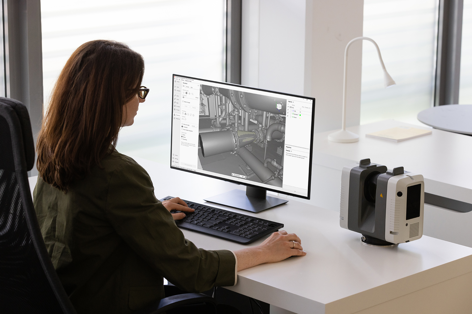
Artec Studio
From Raw Scan To CAD
Artec Studio is the advanced software engine that transforms raw data into production-ready 3D models. It simplifies data processing with an automated Autopilot mode for quick, guided workflows, while leveraging a powerful AI-driven HD Mode to eliminate scan noise, resolve sharp edges, and dramatically enhance mesh resolution across supported hardware. Beyond simply processing meshes, the software features built-in Scan-to-CAD tools for fitting geometric primitives, basic metrology for full-color deviation heat mapping, and seamless direct exports to industry-standard engineering platforms like SOLIDWORKS, and Geomagic Design X, effectively bridging the gap between your physical object and an editable CAD environment.
Frequently Asked Questions
Yes, it is designed for demanding outdoor and field deployment. It features an IP54 environmental ratinging, meaning it is protected against dust ingress and splashing water from any direction. It operates seamlessly in temperatures ranging from -5°C up to +40°C, and can even work in extended low temperatures down to -10°C if proper startup procedures are followed.
Additional Resources
Take Advantage of GoEngineer’s Extensive Knowledge Base and Resources

Find a Solution
Our robust Knowledge Base contains over 12,000 resources to help answer your product design questions. From basic CAD questions to in-depth guides and tutorials, find your solution here. Find a Solution

PROFESSIONAL TRAINING
Improve your skills with professional training and certifications in SOLIDWORKS, CAM, 3D Printing, and 3D Scanning offered four ways: self-paced, online, on-site, or in-classroom. Certified Training Courses

BLOG
#1 Technical Resource Worldwide - Right at your fingertips. Search or browse through hundreds of SOLIDWORKS tips & tricks, additive manufacturing product developments, announcements, how-to guides, and tutorials. Blog

YouTube Channel
Our YouTube channel hosts hundreds of educational tutorials, product demonstrations, recorded webinars, and best practices for all of our products and services. GoEngineer's YouTube Channel
ONLINE STORE
Order 3D printing materials and consumables, enroll in SOLIDWORKS training classes, and buy official GoEngineer gear directly from our online store. Online Store
WEBINARS
Our engineering webinars are hosted by some of the top experts in the industry. They are always recorded, always free, and always offer a live Q&A. WEBINARS
3D Printing Services
Need to 3D print a part? Our Additive Manufacturing experts will 3D print your part and deliver it to you using the latest technology on one of our professional FDM, PolyJet and SL 3D printers. 3D Printing Services